top of page
2015 Remote Sensing Project


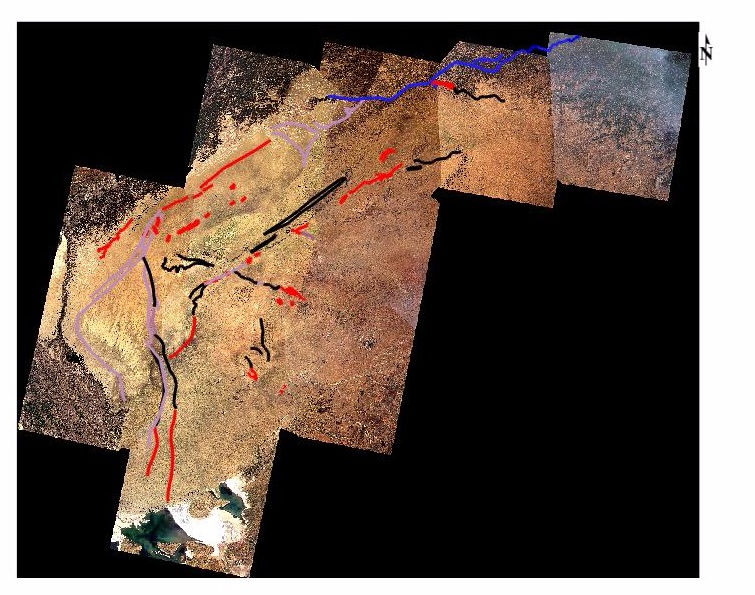


Blue Line: Current Ghaggar river
Red Line: Features mapped in Landsat RGB image
Megenta Line: Features mapped in Decorrelation Stretched image
Black Line: Features mapped in SRTM image
bottom of page
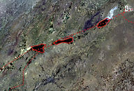
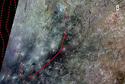
Blue Line: Current Ghaggar river
Red Line: Features mapped in Landsat RGB image
Megenta Line: Features mapped in Decorrelation Stretched image
Black Line: Features mapped in SRTM image